Resolution Bay

Completely open to all SE to S winds but otherwise gives good shelter.

The coves on the south-west shore do offer protection from S winds but it is difficult to get suitable anchorage because of the depth.

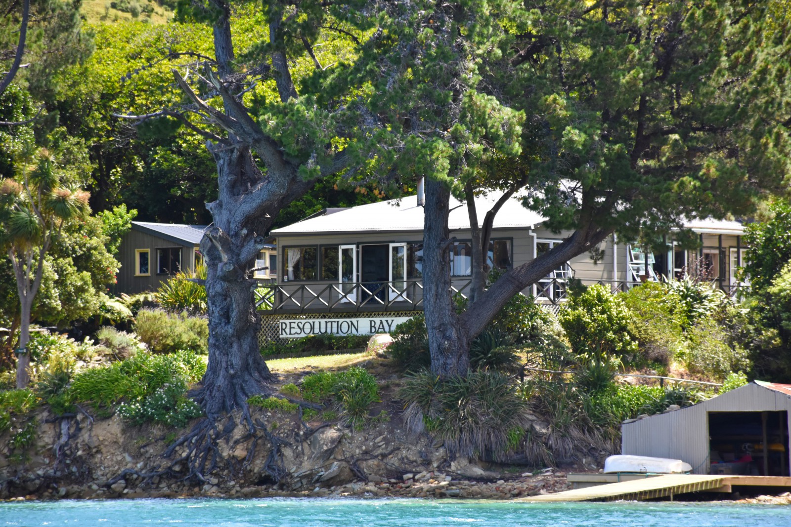
There is a holiday resort in the northern arm of the bay and limited stores can be obtained here.

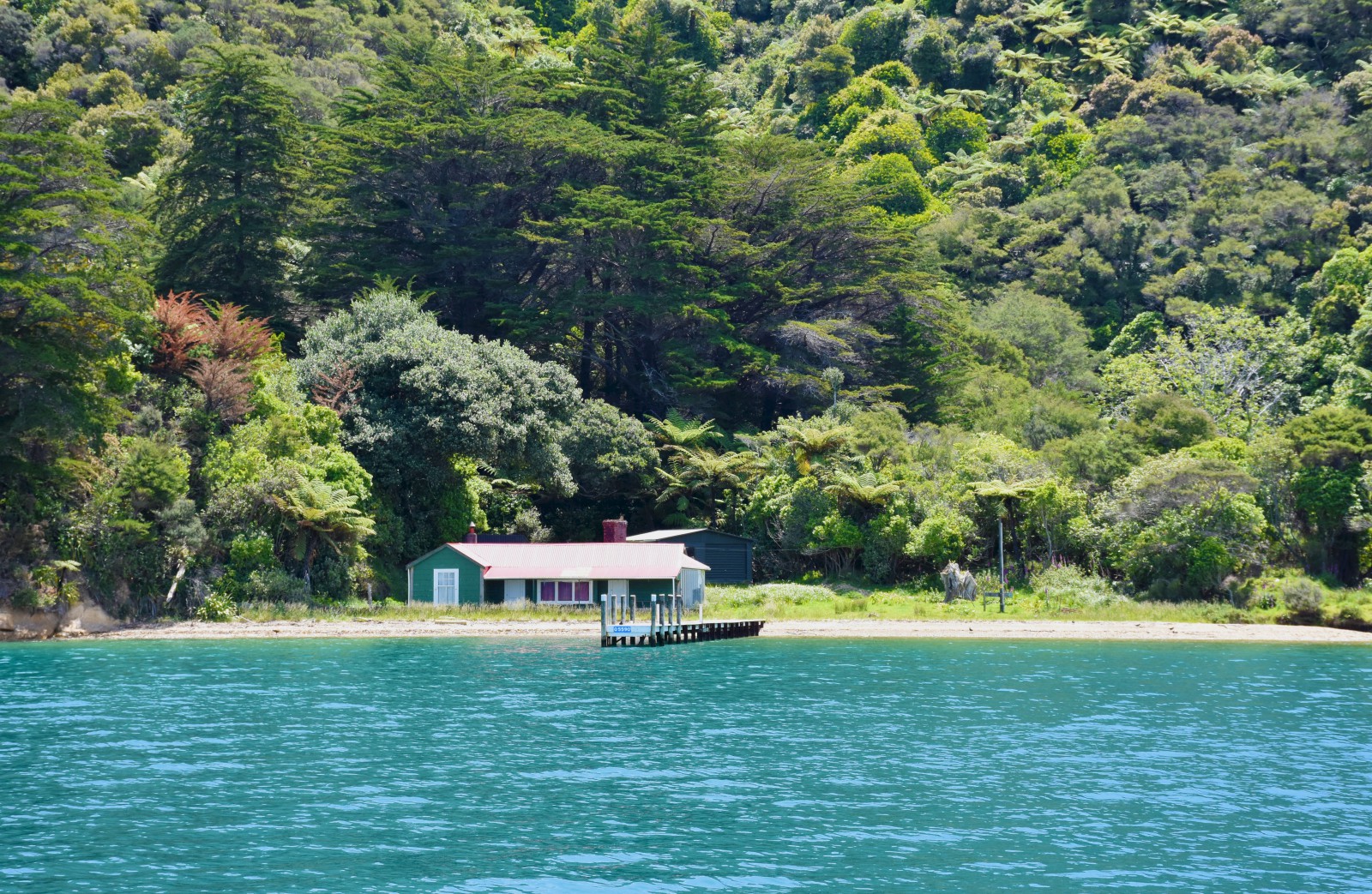
Water is available from the wharf.

A number of large rocks below the surface are visible on the southern side of the wharf. These are over three metres below the surface and no danger to cruising boats.

A walking track leads from the holiday resort to Ship Cove. This track is through beautiful native bush. It takes about one and a half hours to walk to Ship Cove.

In N sector winds the best anchorage is as indicated to the north-east of the holiday resort.

In the coves leading out to Bottle Rock there is shelter from N to NE winds if pulled close to shore with a stern line but holding can be difficult.

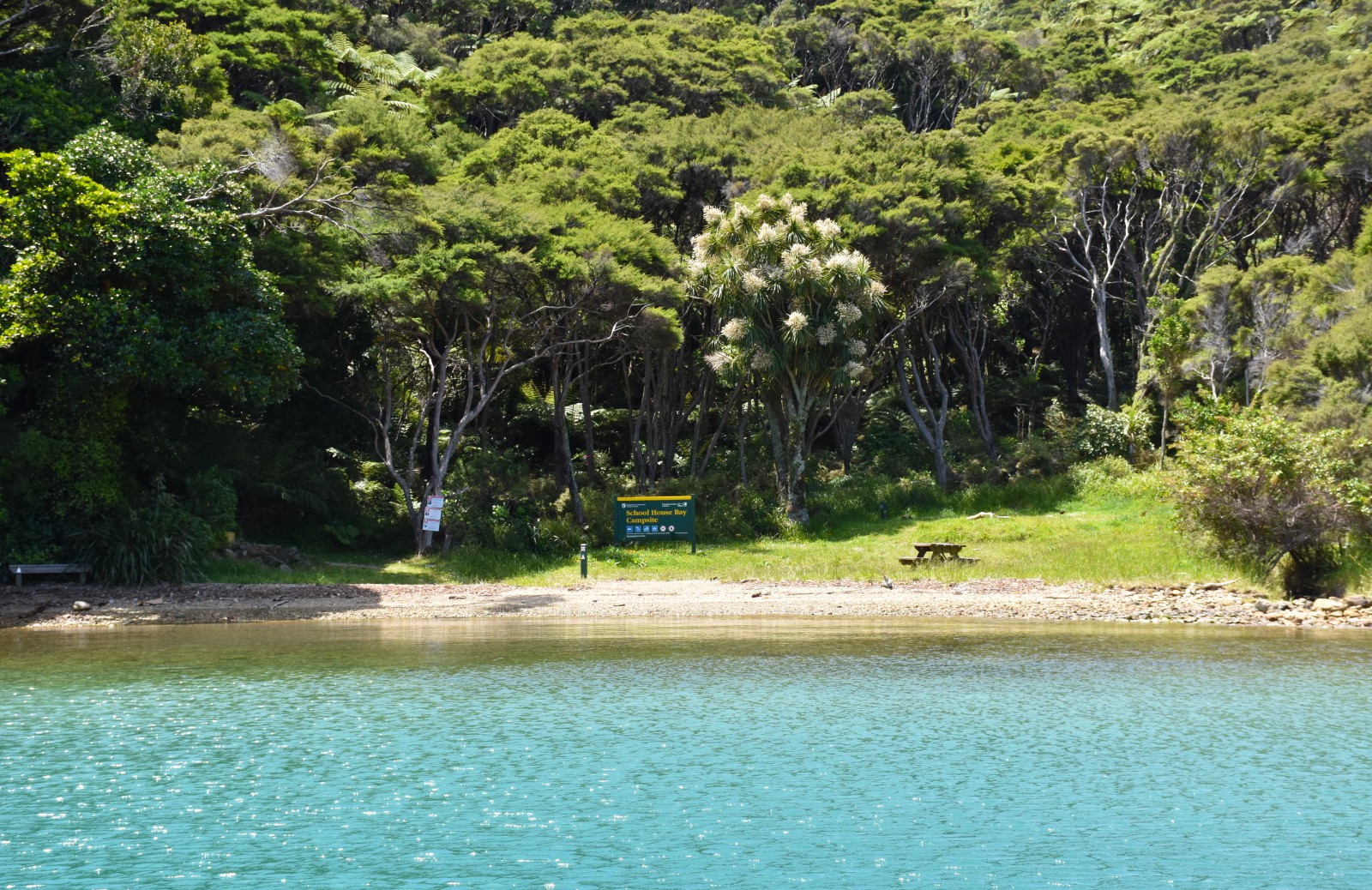
The anchorage in Schoolhouse Bay (in the northern arm of Resolution Bay) can be very gusty in bad SW and N winds and is open to other wind directions.

There is a Department of Conservation (DOC) campsite found here that can only be accessed by boat


History

The Māori name for this bay is Atapu. Some debate surrounds this name and it has been suggested that the correct name may be O-Tapu, (a sacred place) or Ata-po (early dawn). Captain James Cook named the bay Shag Cove, but later explorers gave it the present name in recognition of Cook’s second vessel, Resolution.

Resolution Bay/ Atapu was sold to the Crown in 1859 as part of the Waitohi Purchase in 1850, when Waitohi, later renamed Picton, was purchased from Te Atiawa. By the late 1860s land in the bay was being bought and sold by settler farmers. By the First World War there was a timber mill operating.

The ore antimony, a led-grey metal usually found in quartz rock and used in manufacturing pewter and ammunition, was found on the beach. Mining antimony was eventually to become a thriving local industry in the neighbouring bay, Endeavour Inlet. [1]

At Schoolhouse Bay, within Resolution Bay/ Atapu, a school was established from 1904. It ran periodically depending on the number of students present. The school was an aided school, it was financially supported by local families and the teacher would board at nearby homesteads. Students would walk or ride to school along bridal paths that now form part of the Queen Charlotte Track. [2]

Most of land in the bay has now returned to Crown ownership. From 1960s a holiday camp was established and today there is a holiday resort and café. [3]


[1] Loreen Brehaut, “Resolution Bay or Atapu”, The Prow, accessed December 7, 2017 http://www.theprow.org.nz/places/resolution-bay-atapu/#.Wij6eEqWbIU

[2] “Track History”, Queen Charlotte Track Inc., accessed November 11, 2017 http://www.qctrack.co.nz/the-track-surrounds/track-history/

[3] “Resolution Bay or Atapu.”

More...
Popularity
Low
Anchorage
Mid
Shelter
Shelter
Holding
Good
Depth
Mid - Deep
Type of beach
Rocky
Moorings
Between 5 and 20 | This is referring to the easternmost of the three Clubs’ moorings in Resolution Bay. It is more tucked into cove than the other two. It has access to the Queen Charlotte Track and is a very sheltered mooring in South West to North East. It is currently limited to one boat at a time of maximum boat length 13.5m.